How to learn to stay within a research area?


Only during a search exercise one realizes how fast time passes.
One plans to do a certain job, but sometimes it’s hard to achieve the predeterminated goal.
We stop, we look around, we make the stoke of the situation, trying to understand where we are, and so many doubts arise: is there a map? where did I put it? you look for it in the trousers, in the jecket; it’s raining…is it wet? What about GPS? We have it, but where? In which pocket? has it been turned on? how was it set? and the batteries?
At this point, why don’t we learn how to control where we are- are we in the assigned area, doing the “right thing”?, only by giving a blink of an eye on our wrist?
Yes! Yes we can do it and we will see also how and why, true Davide Quaglini?
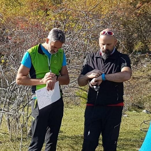
During a training session, I tried to use a watch to learn how to stay within the assigned area, respecting the initially stated search tactic. Difficult? Yes, the first time I had difficulties. Afterwords, by adjusting some device settings, making them more personalized, and more functional, I was able not only to follow and verify the work in real time, but also to optimize the search tactics in the field.
As always, the "Pros" come alongside with "Cons", at it is necessary to finde the right balance.
The sportwatch that guarantees a minimum of functional performance that we need:
· it has its cost
· it has a small screen
· it has a limited autonomy
· I have to know how to use it
· etc ...
However I have put in the field what I had. I took and exhumed my old and reliable Garmin Fenix 2 and compared it, to a cheaper smartwatch, the Amazfit Pace.
The result? There it is!
We need to keep in mind that a sportwatch or smartwatch are not the Palm GPS with an external antenna; they are tools that do a lot of things good, but they are not created to be used the way we are going to use them.
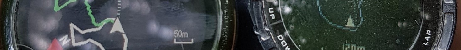
The first thing to keep in mind is that the representative accuracy of a sportwatch or smartwatch that has a 1.5 inch screen does not have the same visualisation as a GPS with a 3 inch or larger screen;
The second thing to take in the consideration is that, the size of the trace varies from 1.2 meters to 3 meters per pixel, depending on the model and the zoom we apply;
Furthermore, the possibility of putting a background map or not can help or distract us - think about contour lines, roads, paths, streams, tracks ... all together in the 1.5 inch screen where each pixel represents about 2 meters, or have only the trace of the area and the registration of the work being done.
Another very important aspect that doesn’t have to be underestimated is the battery life.
In a training session or during an emergency, the intervention can last several hours, leading to the discharge of the battery and therefore to the shutdown of the device.
The technology in this sense has created competition and generated a whole series of more or less simple and more or less technologically advanced devices.
We are not going to look an aesthetics, weil it is an Optional too subjected to individuality, we are going to make a focus on how to implement this idea of using a sportswatch or smartwatch in research.
To optimize the work, first of all it would be advisable to eliminate all those things that could create confusion and / or distraction: let's remove the background maps, exempt roads; we activate the track of the area in which we want to learn to stay; we set the clock for a sport such as running or walking. Remember to activate the map view in the registration options and maybe, where possible, set a light color for the area and, a visible color for a registration, preferably in contrast with the color that we choose for the area.
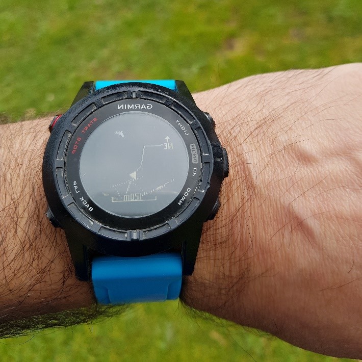
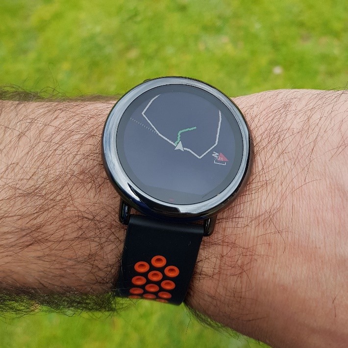
The thing is relatively simple, eventhough we need to use the Function of displaying the track in anomalous way. In this case, we use the function of displaying the track to follow, as the perimeter of our working area (blue track).
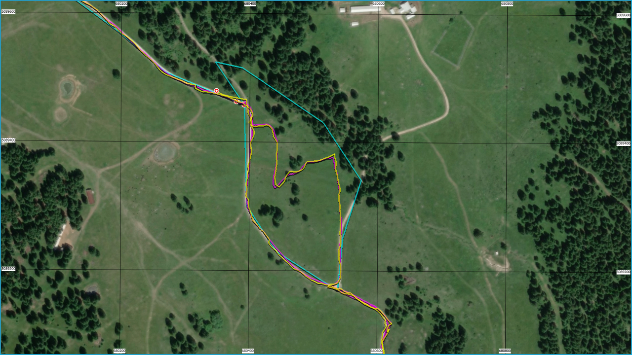
As you can see in the image, the sportwatch track (yellow track) and smartwatch (red track) track overlap and do not differ much. Therefore, there reliability is also similar.
We wait for the clock to tune with the satellites and there we go!
At the end, we download and analyze the recorded track, verifying wheather the work done is consistent with the hypothesized intervention tactic.
Good job and let me know!


